The ICLRD and the All Island Research Observatory (AIRO) have developed all-island interactive data and mapping tools available online:
Island of Ireland Housing Monitoring Tool
This mapping and querying tool for housing market indicators combines data from both Northern Ireland and The Republic of Ireland. By facilitating access to comparable statistics, the Island of Ireland Housing Monitoring Tool can be a key step towards addressing common difficulties in the housing sector (read more).
All-Island Accessibility Mapping Tool
This tool shows the levels of ‘drive-time’ accessibility to key settlements and services on the Island of Ireland. The maps highlight areas with low level of access to services, identify areas with potential to share services, and help to assess differences in service provision levels between Northern Ireland and the Republic of Ireland.
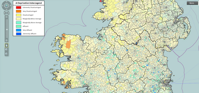
All-Island Deprivation Index
This research responds to a long-standing need to measure deprivation to facilitate cross-border programmes and initiatives. For the first time, the 2011 Census has been co-ordinated throughout all European countries, grounding the feasibility and utility of developing small area deprivation measures at an all-island level. The overall index draws on ten indicators to express a combination of three dimensions of relative affluence and deprivation: demographic profile, social class composition and labor market.
This research is part of the INTERREG IVA funded Cross-Border Spatial Planning and Training Network (CroSPLaN) data capture initiative.

